Current Information
SPRING-SUMMER 2022
Alpine hut open on weekends in good weather until the end of May 2022; open every day from the end of May to October 2022.
Before setting off, always contact the alpine hut by telephone to verify that it is actually open.
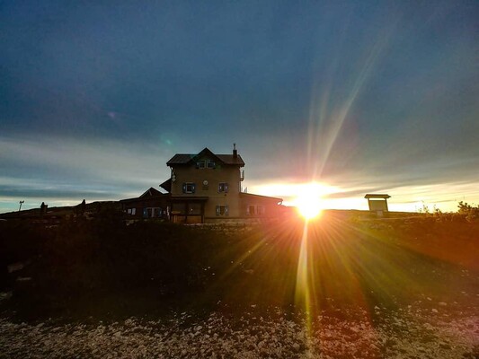
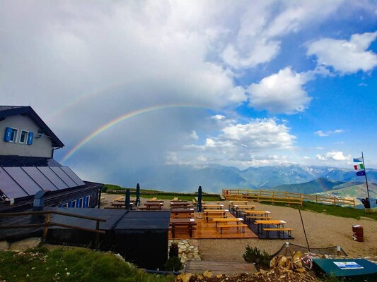
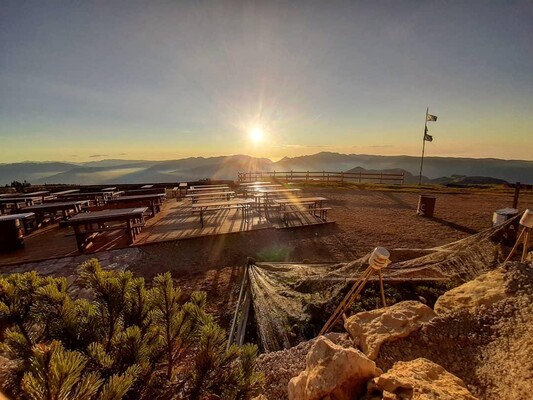
Arriving at the Rifugio Altissimo Damiano Chiesa you’d think you were in Norway, with Lake Garda 2000 m below winding between the mountains like a northern fjord, blue, narrow and deep. These are the secrets of this refuge on the Monte Baldo massif, which in summer (and very often in winter, too) is one of the most well-loved and popular in southern Trentino.
Rifugio Altissimo has five 6-bed rooms and the bivouac for 10 people.
Opening
Open every day until Sunday 4th October.
From the following week Rifugio Altissimo opens only on good weather weekends
Before the excursion it is advisable to verify the actual opening of Rifugio Altissimo by contacting the manager.
Walks
Starting from Nago, going up the mountain, you will find memories of the first World War. But also starting from San Giacomo, near Malga Campo, you can see important rural architecture sites used for wild pastoral activities.
You can also start from Rifugio Graziani, along the old military way (number 633) used during the war, reaching the Rifugio in approximately one hour and a half.
Going along path number 651, in 5 hours you reach the Rifugio Telegrafo, on the top of the mountains looking at Garda lake.
In winter, a lot of ski-alpinists or people with snowshoes (ciaspole) arrive at Rifugio Altissimo, coming from San Giacomo along path number 622.
-
 Trentino Guest CardIf you book here you will get the Trentino Guest Card directly with your booking confirmation. It gives you free entry to all the main museums, and exclusive services. It allows you to circulate freely on public transport.
- Trentino Mountain' Refuges
- SAT
Health and security measures
- Distance rules are kept
- Min. distance between tables and seatings or distance by separators
- Separation or physical barriere between staff and guests in corresponding areas
- Sensitizing of employees to meet min. distance rules
- Employees wear surgical masks
- Employees are informed about prevention and hygiene measures and correct behaviour when Covid19 symptoms or infections appear
- Disinfecting of rented equipment
- Accommodation is disinfected between every guest stay
- Room cleaning includes ventilation, change of cleaning tissues and disinfection of gloves after every room
- Rooms are cleaned most thoroughly after every guest departure, in particular often touched items
- Disinfection of often touched items and surfaces
- Usage of cleansers that are effective against Corona Virus
- Laundry is washed at highest temperature that is allowed by producer
- Bedlinen, towels and laundry are washed according to rules of local authorities
- Regular ventilation of commonly accessible areas
- All plates and dishes, cutlery, glasses are disinfected
- Compliance of distance in all food areas
- Delivered food is packed in secure mode
- Served breakfast
- Clinical thermometer for guests provided by accommodation
- Staff follows all security rules of the local authorities
- Surgical mask for guests available
- Well visible stand-up display with Covid19 rules in front of entrance
- Disinfectant for hands in accommodation and common rooms
- Distance lettering on bottom in critical areas
- First aid kit available
- Storing of staff roster for four weeks
Facilities
-
Location
- altitude (mt. a.s.l.): 2053
-
Beds & rooms
- multi-bed room/s: 7
-
Facilities / Services
- restaurant
- bar
-
Conditions
Open: from early May to mid-October every day, then on weekends with good weather.
Make sure the opening on the website or on FB. Payment can only be made by cash or bank transfer
Contact & Directions
ALTISSIMO "DAMIANO CHIESA"
38060 BRENTONICO IT
Arrival
From Rifugio Graziani
1,15h.
You can reach San Valentino directly from Avio via the Val dei Molini or from Brentonico. S.P 3 to the Graziani refuge,1620 m. (5 km from San Valentino). From the car-park after the Graziani refuge follow the 633 SAT dirt road to the Altissimo refuge (60-75 min. walk). This is the classic route, easily reached in summer, a bit more tiring in winter due to the ban on all vehicles.
Trekking/MTB/EBIKE/Family
Round tour from the Graziani Refuge-Altissimo Refuge-Campei Refuge-Malga Campo-Graziani Refuge
About 4.30 hours.
Park the car at the Rif. Graziani car park, take road 633 which leads to the peaks of Monte Altissimo, to the Altissimo Refuge. From here take the path 601 to Monte Varagna and then turn right and take the 624 up to the Campei Refuge. Continue with the 624b until the intersection with the 650 which continues towards Malga Campo, until you reach the Rif. Graziani.
Trekking
From Nago. 222 m.
From Nago follow the road signs for Monte Altissimo del Baldo. The tarmac road leads to a car-park at 1550 m. altitude, north of Mount Varagna. The walk begins on a dirt trail and then onto the 601 SAT path towards Mount Nago, 1875 m. Keep on following the signs painted on the rocks and you'll eventually see the refuge on your right. Walking time: 90-105 minutes from the car-park.
Trekking/MTB/Family
From Malcesine 89 m.
Take the cable-lift: it's a wonderful way to admire the surrounding environment. Once off the cable-lift turn left to the Baita dei Forti, 1752 m, and follow path 651 over the grassy meadows of the Colma di Malcesine. From here you descend along path 651 to the Bocca di Navene at 1,425m. Keep on the main road and follow the 651 path off the tarmac road up to the Navene ridge, over the Laste di Tolghe ridges to the Busa Brodeghera. The path continues on a dirt track to the Altissimo refuge. Walking time: 150 – 170 min.
Trekking/MTB
From Nago-Rifugio Altissimo-Brentonico-Nago
(Mtb/Trekking loop ride)
This is one of the more classic routes that South Trentino offers. Apart from the beauty of the environment, the awesome landscape of Lake Garda, and the breathtaking view from the natural balcony of Mount Altissimo, it remains, however, a challenging route both for its altitude difference and its length. In some parts you might have to push your bike, especially on path 601 due to the uneven ground, just below the summit. The tiring ascent is rewarded with the stunning 360 degree views.
This route starts from Nago centre. Follow the indications for Mount Baldo. It's a tarmac, uphill, road, quite challenging in some stretches, but luckily most of it is in woodland. The road ends at the “prati di Nago” car-park at 1530 m. From this point, follow the 601 SAT path: a compact but sometimes uneven dirt road. You might need to push your bike towards the end of the climb. Once reached the refuge you can taste the typical dishes of the area. It's recommended to visit the little church and the panoramic point where all the surrounding summits are named and, of course, last but not least, don't forget to walk to the top of Mount Altissimo to enjoy the spectacular view over Lake Garda and the surrounding valleys. The descent is on the winding 633 SAT dirt road to the Graziani refuge. The trail alternates stretches of compact surfaces to gravelly terrains. From the Graziani refuge, 1620 m., follow the indications for San Valentino on the S.P. 3. A tarmac road leads to San Valentino, San Giacomo di Brentonico, Brentonico and then Mori. From here you can take the bike trail to Nago. An alternative route: after Brentonico, take the road to Castione and from the small square continue left to Sano after which you can take the bike trail that goes from Loppio to Nago.
Mtb/Ebike/Trekking loop ride
From Malcesine-Bocca Navene-Rifugio Altissimo-Nago-Malcesine
(Mtb/trekking loop ride)
From Malcesine, take the cable car to the top,1750 m. From here, descend on the dirt road, it's quite steep, to the tarmac provincial road (S.P.3) of Monte Baldo. This road will lead you quickly to the Bocca di Navene at 1425 m. From here onto the main road to the Graziani refuge (1620 m). Turn left and follow the directions for Mount Altissimo. The 633 SAT dirt road takes you onto an uneven and winding terrain to the Altissimo refuge at 2060 mt, just a few metres under the summit of Mount Altissimo ( 2079mt). Once reached the refuge you can taste the typical dishes of the area. It's recommended to visit the little church and the panoramic point where all the surrounding summits are named and, of course, last but not least, don't forget to walk to the top of Mount Altissimo to enjoy the spectacular view over Lake Garda and the surrounding valleys.
The descent is via the 601 SAT path. The first part is very steep and uneven, but then the path is quite flat up to the dirt road and then onto the Prati di Nago car-park at 1530 m. The descent continues on tarmac road to Nago where you follow the directions for Busatte park. From here follow the road for Torbole and then for Malcesine.
Mtb/Ebike/Trekking loop ride
From San Giacomo, 1196 m. (hamlet of Brentonico)
Follow path 622 to Malga Campo (1667 m) and then across the NE ridge to the refuge: 140 – 160 min. walk. This is a very popular route in winter for alpine ski lovers.
Trekking
From the Bocca di Navene, 1425 m.
There are 2 ways to reach this locality: the first is via the cable-way from Malcesine, the second is via the Monte Baldo provincial road from San Valentino to the Graziani refuge.
The walk starts on a tarmac road to the start of the 651 SAT path that you'll see on your left. The first part of the path goes through woods, over the Navene ridge, then up over the ridges of the Lastè di Tolghe and onto the Busa Brodeghera. From the grassy meadows, the path leads onto an old military path and then onto the 633 SAT dirt path, that takes you to the Altissimo refuge.
Walking time: c 90-120 minutes.
Trekking
Trust-You rating
" Video"
RIFUGIO ALTISSIMO Damiano Chiesa" Photos"
-
No booking fees
-
Exclusive offers
-
100% secure platform
-
Trentino Guest Card immediately for you


