Olympics 2026

Milano Cortina - Offical Partner for Olympics and Paralympics 2026

Exploring Ledro Land Art

Hiking trail

Hiking trail recommended route

Exploring Ledro Land Art

Hiking trail · Ledro Open
Logo Garda Trentino
Responsible for this content
Garda Trentino Verified partner 
  • Cow show
    Cow show
    Photo: Stefania Oradini, Garda Trentino

Selected alternatives for you

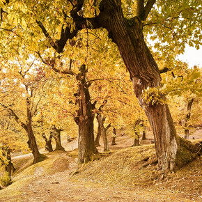
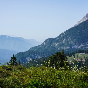
    Ledro Land Art is an environmental art park immersed in the pinewood of Pur, one of the green lungs of the Valle di Ledro, where artistic creativity meets nature.

    Open
    easy
    Distance 2.6 km
    1:00 h
    67 m
    67 m
    760 m
    693 m

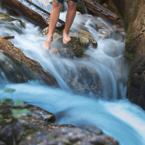
    Along the suggestive path that runs along the Assat torrent and leads to Malga Cita, the landscape acts as keeper of the site-specific installations that are created every year during summer season.

    Trees in love, stone cows, giant violins, hands rising from the ground, swing woods, metal snails… These are some of the wonders to be seen in Ledro Land Art.

    Author’s recommendation

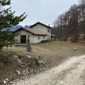
    At Malga Cita, not far from Ledro Land Art, there’s a picnic area fitted with barbecues.

    Profile picture of Staff Outdoor Garda Trentino AC
    Author
    Staff Outdoor Garda Trentino AC
    Logo Garda Trentino
    Responsible for this content
    Garda Trentino  Verified partner 
    Difficulty
    easy
    Overall difficulty
    easy

    Derived from the technical difficulty and the stamina requirements.

    Experience
    Landscape
    Highest point
    760 m
    Lowest point
    693 m
    Best time of year
    Jan
    Feb
    Mar
    Apr
    May
    Jun
    Jul
    Aug
    Sep
    Oct
    Nov
    Dec

    Track types

    Asphalt 28.61%Dirt road 5.22%Path 62.82%Unknown 3.34%
    Asphalt
    737 m
    Dirt road
    135 m
    Path
    1.6 km
    Unknown
    86 m
    Show elevation profile

    Safety information

    The telephone number for the emergency services is 112.

    The information on this chart is subject to inevitable variations, so this means that none of the indications are absolute. It is not entirely possible to avoid giving inexact or imprecise information, given how quickly environmental and weather conditions can change. For this reason we decline any responsibility for changes which the user may encounter. In any case, the hiker is advised to check the conditions of the places, environment and weather before setting out.

    Tips and suggestions

    You’ve picked the perfect trail – now make sure you’re ready to enjoy it to the fullest. Local hiking specialists are here to help: guides, shops and experts with the tips and support you need for every step of the way.

    Public transport

    Public-transport-friendly

    Valle di Ledro is connected to Riva del Garda by the intercity bus line 214 (Riva-Valle di Ledro-Storo). Bus stop: Molina di Ledro and then on foot to Pur for about 3 km.

    Up-to-date information on timetables and routes.


    Get Timetable to destination

    to
    Exploring Ledro Land Art

    Directions

    Exit the A22 motorway at Rovereto Sud – Lago di Garda. Follow the SS240 della Val di Ledro to Molina di Ledro. At the Pile-Dwelling Museum turn left towards Pur. At the beach turn left and follow the signposts to Ledro Land Art. 

    Find out how to reach Garda Trentino.


    Parking

    Car park at the beginning of Ledro Land Art.

    Coordinates

    DD
    45.863021, 10.738139
    DMS
    45°51'46.9"N 10°44'17.3"E
    UTM
    32T 634919 5080297
    w3w 
    ///plateful.affiliates.salary
    Get there by train, car, bike, or on foot!

    Author’s map recommendations

    Garda Trentino TREKKING Map – Available in the info points of Garda Trentino (Riva del Garda, Arco, Torbole sul Garda, Ledro, Comano Terme)

    Equipment

    This excursion is quite simple and presents no particular difficulty. However, we still recommend you to wear suitable footwear, a hat, sun screen and sunglasses. And be sure to bring water!

    Similar routes nearby

    • The meadows of Legos
    • Walking around Lake Ledro
    • Lakeside walk
    • Pieve - Memories on show
    • Colle di Santo Stefano
     These suggestions were generated by our system
    Status
    Open
    Difficulty
    easy
    Overall difficulty
    easy

    Derived from the technical difficulty and the stamina requirements.

    Distance
    2.6 km
    Duration
    1:00 h
    Ascent
    67 m
    Descent
    67 m
    Highest point
    760 m
    Lowest point
    693 m
    Public-transport-friendly Round trip Scenic Family-friendly Cultural/historical interest

    Weather at the starting point

    10-day forecast

    Statistics

    • Content
    • Show images Hide images
    Features
    2D 3D
    Maps and trails
    Nothing selected - click and drag in the elevation profile to zoom
    Distance
    Duration
    Ascent
    Descent
    Elevation profile


    You may also like ...

    728 results
    40 - Tour of the Fortresses | © Azienda per il Turismo Alpe Cimbra

    40 - Tour of the Fortresses

    Passeggiata Rore (Canal San Bovo) | © APT San Martino di Castrozza, Primiero e Vanoi

    Passeggiata Rore (Canal San Bovo)

    Senter del Menador | © Unknown

    SAT / E201 - Senter del Menador

    Passeggiata - Lago Grande | © APT Valsugana e Lagorai

    Passeggiata - Lago Grande

    Cherle Tour | © Azienda per il Turismo Alpe Cimbra

    Cherle Tour

    Passeggiata alla Madonna di Feles | © Consorzio Turistico - Vigolana

    Passeggiata alla Madonna di Feles

    Nei pressi di Pradel | © APT Dolomiti di Brenta e Paganella

    Walk from Molveno to Pradel

    Rifugio Al Cacciatore | © APT Dolomiti di Brenta e Paganella

    Walk to the fossil deposits in Val d'Ambiez

    40 - Tour of the Fortresses | © Azienda per il Turismo Alpe Cimbra

    40 - Tour of the Fortresses

    During the First Great World War (1914-1918), the Alpe Cimbra, close...

    Read more ...
    Passeggiata Rore (Canal San Bovo) | © APT San Martino di Castrozza, Primiero e Vanoi

    Passeggiata Rore (Canal San Bovo)

    Read more ...
    Senter del Menador | © Unknown

    SAT / E201 - Senter del Menador

    This is the oldest route between Levico and the Vézzena Plateau, an...

    Read more ...
    Passeggiata - Lago Grande | © APT Valsugana e Lagorai

    Passeggiata - Lago Grande

    Very easy walk in the greenery that offers you an unique panorama.

    Read more ...
    Cherle Tour | © Azienda per il Turismo Alpe Cimbra

    Cherle Tour

    The Cherle ridge, between the upper Val d'Astico and the Fiorentini...

    Read more ...
    Passeggiata alla Madonna di Feles | © Consorzio Turistico - Vigolana

    Passeggiata alla Madonna di Feles

    Between the villages of Bosentino and Vigolo Vattaro stands the...

    Read more ...
    Nei pressi di Pradel | © APT Dolomiti di Brenta e Paganella

    Walk from Molveno to Pradel

    A walk along a forest road in the woods between Molveno and the...

    Read more ...
    Rifugio Al Cacciatore | © APT Dolomiti di Brenta e Paganella

    Walk to the fossil deposits in Val d'Ambiez

    In Val d'Ambiez, discover ancient Megalodon fossils: the Dolomites...

    Read more ...