Gorg d'Abiss
Hiking trail
Gorg d'Abiss
<p>Perfect route for families with children looking for a light and quiet walk but not wanting to renounce to a dash of outdoor adventure.</p>
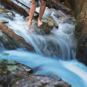
<p>Which is the tallest bell tower in Trentino? The villages of Tiarno di Sotto and Pinzolo, in the near Val Rendena, are both in contention for this record. Both clock towers are about 72 m tall. The interior of the church is also worth a look! At the beginning of the path leading to the waterfall, the Mulino dei Bugatini is the only water mill still in existence along the Massangla. Gorg d’Abiss, vortex of the abyss. This colourful name belongs to the waterfall formed by the Massangla over the centuries.</p>
Gorg d'Abiss

Garda Trentino Verified partner
Perfect route for families with children looking for a light and quiet walk but not wanting to renounce to a dash of outdoor adventure.
Which is the tallest bell tower in Trentino? The villages of Tiarno di Sotto and Pinzolo, in the near Val Rendena, are both in contention for this record. Both clock towers are about 72 m tall. The interior of the church is also worth a look! At the beginning of the path leading to the waterfall, the Mulino dei Bugatini is the only water mill still in existence along the Massangla. Gorg d’Abiss, vortex of the abyss. This colourful name belongs to the waterfall formed by the Massangla over the centuries.
Author’s recommendation
Relief from the summer heat in the coolness of the wood and the torrent.
Garda Trentino Verified partner
Derived from the technical difficulty and the stamina requirements.
Track types
Show elevation profileSafety information
The telephone number for the emergency services is 112.
The information on this chart is subject to inevitable variations, so this means that none of the indications are absolute. It is not entirely possible to avoid giving inexact or imprecise information, given how quickly environmental and weather conditions can change. For this reason we decline any responsibility for changes which the user may encounter. In any case, the hiker is advised to check the conditions of the places, environment and weather before setting out.
Tips and suggestions
You’ve picked the perfect trail – now make sure you’re ready to enjoy it to the fullest. Local hiking specialists are here to help: guides, shops and experts with the tips and support you need for every step of the way.Roadbook
Start from the church. Take Via Alla Sega and turn into Via Všeň. Proceed on the path along the torrent to the waterfall. Return along the same route.
Public transport
Public-transport-friendly
Valle di Ledro is connected to Riva del Garda by the intercity bus line 214 (Riva-Valle di Ledro-Storo).
Up-to-date information on timetables and routes.
Get Timetable to destination
Directions
Exit the A22 motorway at Rovereto Sud – Lago di Garda – Follow the SS240 della Val di Ledro to Tiarno di Sotto.
Find out how to reach Garda Trentino.
Parking
Parking in Piazza San Giovanni Bosco in Tiarno di Sotto, in front of the church.
Coordinates
Author’s map recommendations
Garda Trentino TREKKING Map – Available in the info points of Garda Trentino (Riva del Garda, Arco, Torbole sul Garda, Ledro, Comano Terme)
Equipment
This excursion is quite simple and presents no particular difficulty. However, we still recommend you to wear suitable footwear, a hat, sun screen and sunglasses. And be sure to bring water!
Localization
Derived from the technical difficulty and the stamina requirements.


