Lago di Tenno Gravel Experience
Gravel Bike
Lago di Tenno Gravel Experience
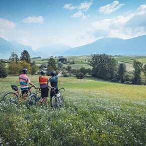
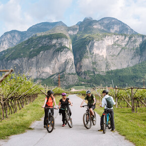
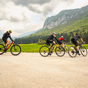
<p>A journey through the main historic centres of Garda Trentino, its beaches and olive groves before ascending to the area of Tenno through to the Ballino Pass.</p>
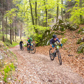
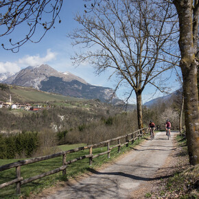
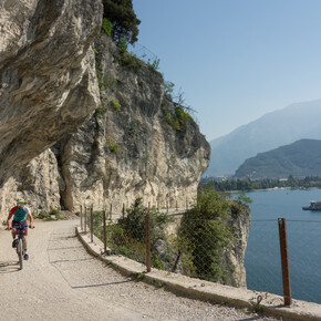
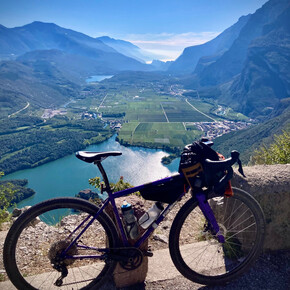
<p>Marvellous panoramic views, slopes that can become steep at times, various types of surfaces, all of which can be cycled, even if not all typically on a gravel bike. This type of cycling can be interpreted in a broad variety of ways, while here it obviously reflects the particular nature of the area. Woods, mediaeval villages and the splendid Lake Tenno with its turquoise waters are the main features on this section of the route. The return towards Garda passing vineyards and olive groves is surprising in any season. </p> <p>The dialect term “Busa” is used to refer to the valley north of Lake Garda, home to Arco, Riva and Torbole.</p> <p>The proposed route starts out from Arco, then passes through Nago, Torbole and Riva, but since it forms a loop, you can choose to start anywhere from one of these towns. </p>
Lago di Tenno Gravel Experience

Garda Trentino Verified partner
A journey through the main historic centres of Garda Trentino, its beaches and olive groves before ascending to the area of Tenno through to the Ballino Pass.
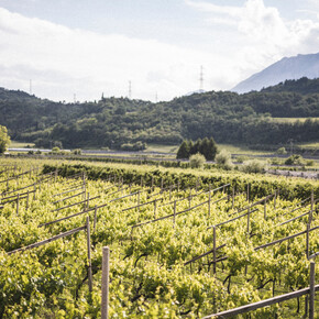
Marvellous panoramic views, slopes that can become steep at times, various types of surfaces, all of which can be cycled, even if not all typically on a gravel bike. This type of cycling can be interpreted in a broad variety of ways, while here it obviously reflects the particular nature of the area. Woods, mediaeval villages and the splendid Lake Tenno with its turquoise waters are the main features on this section of the route. The return towards Garda passing vineyards and olive groves is surprising in any season.
The dialect term “Busa” is used to refer to the valley north of Lake Garda, home to Arco, Riva and Torbole.
The proposed route starts out from Arco, then passes through Nago, Torbole and Riva, but since it forms a loop, you can choose to start anywhere from one of these towns.
Author’s recommendation
If you come to Lake Tenno in the summer months, it will be hard to resist the temptation to take a dip.
Garda Trentino Verified partner
Derived from the technical difficulty and the stamina requirements.
Track types
Safety information
It is quite difficult to identify the suggested route without using a navigation system to follow the gpx track provided.Safety Tips
- Always wear your helmet.
- Plan your ride.
- Obey the road signs, stop at traffic lights and do not ride on the wrong side of the road.
- You share the trail with other users. Yield right of way to hikers.
- Respect public and private property.
- Do not cycle solo in remote areas.
- Make sure your bike lights are working.
This information is subject to inevitable variations, so none of these indications are absolute. It is not entirely possible to avoid giving inexact or imprecise information, given how quickly environmental and weather conditions can change. For this reason, we decline any responsibility for changes which the user may encounter. In any case, it is advisable to check environment and weather conditions before setting out.
Tips and suggestions
Love getting lost between gravel tracks and quiet backroads? You’ll find more than just support here – you’ll find people who can make every ride even better. Discover gravel specialists ready to help with tips, rentals, repairs and more.Public transport
Public-transport-friendly
The main towns in Garda Trentino - Riva del Garda, Arco, Torbole sul Garda, Nago – are connected by several urban and intercity bus lines which will take you to the starting point of tours or in the immediate surroundings.
You can also get to Riva del Garda and Torbole sul Garda by the public ferry service.
Up-to-date information on timetables and routes.
Get Timetable to destination
Directions
A22 motorway, exit: Rovereto Sud - Lake Garda. Then SS240 in the direction of Riva del Garda - Arco.
Find out how to reach Garda Trentino.
Parking
Parking in Caneve (5 minutes walk to the town centre).
Paid parking: Foro Boario, near the bridge (Via Caproni Maini) or the post office (Via Monache).
Coordinates
Author’s map recommendations
Garda Trentino BIKE Map – Available in the info points of Garda Trentino (Riva del Garda, Arco, Torbole sul Garda, Ledro, Comano Terme).
Equipment
Riding your bike requires specific clothing and equipment, even for relatively short and easy trips. It is always better to be prepared… e.g. for bad weather or a sudden drop in your energy levels. The unexpected things are part of the fun!
Remember to thoroughly evaluate the type of route you plan on doing, the locations you intend to cross and the current season. Has it been raining? Attention: The paths may be slippery and require more caution.
What do I need to bring on my bike tour?
- An adequate water supply according to your needs (considering temperature, possibility of refuelling and duration of the route)
- Plenty of snacks (for example, dried fruit or energy bars)
- Waterproof / Windproof jacket
- A spare top / spare socks (Descending in a sweaty garment, will make you cold).
- Suncream
- Sunglasses
- Bike gloves/mitts
- Map or GPS device
- Bike lights: best placed on your helmet or handlebars. (It is always best to be prepared)
- Bike repair kit for punctures and mechanical breakdowns
- First aid kit
- Emergency whistle
It is always advised to let someone know where you plan to go and how long you expect to be.
Emergency telephone number 112.
Derived from the technical difficulty and the stamina requirements.


