Olympics 2026

Milano Cortina - Offical Partner for Olympics and Paralympics 2026

Ski mountaineering in Val Gelada

Back-country skiing • Madonna di Campiglio, Pinzolo and Val Rendena

Back-country skiing recommended route

Ski mountaineering in Val Gelada

Back-country skiing · Madonna di Campiglio, Pinzolo, Val Rendena
Responsible for this content
VisitTrentino Verified partner 
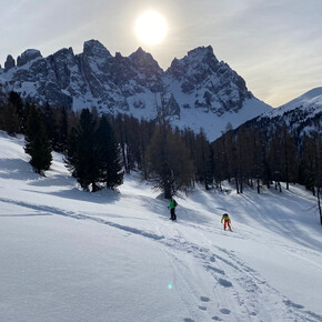
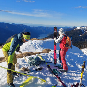
  • la Val Gelada vista dal versante opposto
    la Val Gelada vista dal versante opposto
    Photo: Marco Maganzini Guida Alpina, VisitTrentino
Map / Ski mountaineering in Val Gelada

Selected alternatives for you
    A classic excursion in the northern Brenta that often offers excellent ski runs due to its North-facing exposure.
    moderate
    Distance 11.2 km
    3:30 h
    998 m
    998 m
    2,593 m
    1,629 m

    This excursion does not reach a true summit but a saddle called Bocchetta dei Tre Sassi. The route runs at the base of the northeast face of Cima Vagliana, which divides Val Gelada from the Grostè area, served by ski lifts. The high attendance is also justified by the regularity of the slopes, fairly sustained but never too steep.

    Author’s recommendation

    Always call the local Alpine Guide offices to check conditions (see "useful links").
    Profile picture of VisitTrentino
    Author
    VisitTrentino
    Responsible for this content
    VisitTrentino  Verified partner 
    Difficulty
    moderate
    Overall difficulty
    moderate

    Derived from the technical difficulty and the stamina requirements.

    Experience
    Landscape
    Highest point
    2,593 m
    Lowest point
    1,629 m
    Best time of year
    Jan
    Feb
    Mar
    Apr
    May
    Jun
    Jul
    Aug
    Sep
    Oct
    Nov
    Dec
    Cardinal direction
    NESW

    Track types

    No marked trail 99.99%
    No marked trail
    11.2 km
    Show elevation profile

    Safety information

    Despite high traffic, the avalanche danger should not be underestimated, also due to the presence of steep gullies and side slopes. It is therefore recommended to avoid the route after heavy snowfall and/or significant temperature rises.

    The stability of the snowpack is subject to sudden and unpredictable changes. Always consult the avalanche bulletin (www.meteotrentino.it or others if available for your area) and be well informed about the current conditions at the local Alpine Guide offices ( http://www.guidealpinecampiglio.it ).

    GPX tracks are purely indicative of the generally most sensible route, but cannot be blindly followed without a preliminary evaluation of the slopes at that precise moment.

    As you can imagine, the passability of itineraries in a mountain environment is closely linked to current conditions and therefore depends on natural phenomena, environmental changes, and weather conditions. For this reason, the information contained in this sheet may have changed. Before departing, inquire about the route status by contacting the refuge managers on your route, alpine guides, nature park visitor centers, and tourist offices.

    Tips and suggestions

    http://www.guidealpinecampiglio.it

    https://www.alpinemotion.it/pinzolo/

    Public transport

    Public-transport-friendly

    line 231 suburban transport Trento-Campo Carlo Magno

    Directions

    From Madonna di Campiglio, climb to the start of the Grostè lifts (it is also possible to park here, then take the snowy road that climbs to Malga Mondifrà) and after a few hundred meters you reach Campo Carlo Magno pass. A small downhill road on the right allows you to reach the Centro Fondo Malghette.

    Parking

    At the Centro Fondo (or at the start of the Grostè cable car)

    Coordinates

    DD
    46.246164, 10.845060
    DMS
    46°14'46.2"N 10°50'42.2"E
    UTM
    32T 642231 5123053
    w3w 
    ///soaked.rigged.precocious
    Get there by train, car, bike, or on foot!

    Book recommendation by the author

    "Ski mountaineering in Madonna di Campiglio" - ed.Tappeiner 2011

    Author’s map recommendations

    4Land no.139 - Brenta Group

    Equipment

    For all ski mountaineering excursions, appropriate clothing is recommended even in case of sudden temperature drops and to avoid getting wet from contact with snow (waterproof clothing such as Gore-Tex). Additionally, gloves, hat, sunglasses, and sunscreen should be part of each group member's usual equipment.

    It is MANDATORY to have a self-rescue avalanche kit, consisting of transceiver-shovel-probe (which can also be rented - possibly insert contacts of shops offering the service).

    Helmet or other active protection systems (such as backpacks with ABS-Airbag systems) are strongly recommended.

    In case of hard or icy snow, the use of crampons is advised.


    Localization

    Parts of this content were machine translated using Italian as the source language

    Similar routes nearby

    • Vagliana - Dossi di Vagliana - Ski mountaineering route
    • Skialp by night Grostè
    • Skialp by night Pradalago
    • Trampolino - the Fevri trail - Ski mountaineering route
    • Spinale - Monte Spinale - ski mountaineering route
     These suggestions were generated by our system
    Difficulty
    moderate
    Overall difficulty
    moderate

    Derived from the technical difficulty and the stamina requirements.

    Distance
    11.2 km
    Duration
    3:30 h
    Ascent
    998 m
    Descent
    998 m
    Highest point
    2,593 m
    Lowest point
    1,629 m
    Public-transport-friendly Scenic Out and back Insider tip Summit route suitable for snowboards
    1600 m 1800 m
    Earlier
    1600 m 1800 m
    Later

    Avalanche conditions

    ·

    Weather at the starting point

    10-day forecast

    Statistics

    • Content
    • Show images Hide images
    Features
    2D 3D
    Maps and trails
    Nothing selected - click and drag in the elevation profile to zoom
    Distance
    Duration
    Ascent
    Descent
    Elevation profile


    You may also like ...

    68 results
    Ski mountaineering - Chalet Paradiso to Passo Brocon | © APT Valsugana e Lagorai

    Ski mountaineering - Chalet Paradiso to Passo Brocon

    Ski mountaineering in the Dolomiti di Brenta | © APT Dolomiti di Brenta e Paganella

    Malga Tovre and rifugio La Montanara

    Summit cross on Monte Serodoli, above Madonna di Campiglio | © APT Madonna di Campiglio, Pinzolo, Val Rendena

    Monte Serodoli from the lakes of Nambino, Nero and Serodoli

    E' ora di scendere e si tolgono le pelli | © VisitTrentino

    Scialpinismo a Cima Undici - Val dei Monzoni

    The beautiful view of the Pale di San Martino | © APT Fiemme Cembra

    Piccolo Colbricon

    Skialp track by night | © Madonna di Campiglio Azienda per il Turismo

    Skialp by night Grostè

    Cima Lavazzè with ski mountaineering, Val di Non Trentino | © APT Val di Non

    Classic mountaineering route to Cima Lavazzè in the heart of the...

    Rifugio Dosso Larici | © ph. Multiweb.it

    Santel - Dosso Larici

    Ski mountaineering - Chalet Paradiso to Passo Brocon | © APT Valsugana e Lagorai

    Ski mountaineering - Chalet Paradiso to Passo Brocon

    A great option is the ascent via the Casa Saronnese road, which after...

    Read more ...
    Ski mountaineering in the Dolomiti di Brenta | © APT Dolomiti di Brenta e Paganella

    Malga Tovre and rifugio La Montanara

    Gazing at the Brenta Dolomites.

    Read more ...
    Summit cross on Monte Serodoli, above Madonna di Campiglio | © APT Madonna di Campiglio, Pinzolo, Val Rendena

    Monte Serodoli from the lakes of Nambino, Nero and Serodoli

    A classic among routes starting from Madonna di Campiglio. Varied...

    Read more ...
    E' ora di scendere e si tolgono le pelli | © VisitTrentino

    Scialpinismo a Cima Undici - Val dei Monzoni

    Read more ...
    The beautiful view of the Pale di San Martino | © APT Fiemme Cembra

    Piccolo Colbricon

    The most popular tour in the Lagorai chain offers a fantastic view of...

    Read more ...
    Skialp track by night | © Madonna di Campiglio Azienda per il Turismo

    Skialp by night Grostè

    Fans of ski mountaineering can, on the days and at the times...

    Read more ...
    Cima Lavazzè with ski mountaineering, Val di Non Trentino | © APT Val di Non

    Classic mountaineering route to Cima Lavazzè in the heart of the...

    Classic and very popular route in the Maddalene Group at the border...

    Read more ...
    Rifugio Dosso Larici | © ph. Multiweb.it

    Santel - Dosso Larici

    From Santel to the Dosso Larici refuge with ski mountaineering.

    Read more ...