Olympics 2026

Milano Cortina - Offical Partner for Olympics and Paralympics 2026

Snowshoeing in Tremalzo

Snowshoeing

Snowshoeing recommended route

Snowshoeing in Tremalzo

Snowshoeing · Ledro Open
Logo Garda Trentino
Responsible for this content
Garda Trentino Verified partner 
  • Tremalzo in inverno
    Tremalzo in inverno
    Photo: Stefania Oradini, Garda Trentino

Selected alternatives for you
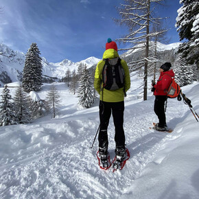
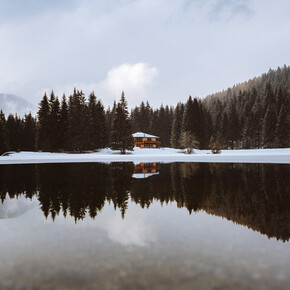
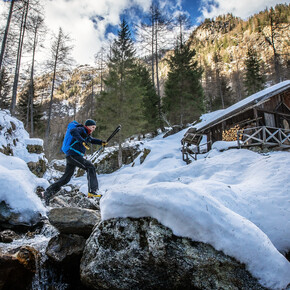
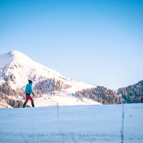
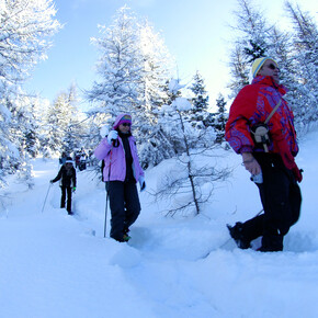
    In Winter Tremalzo gets covered with snow. What better way to explore it than snowshoeing?
    Open
    easy
    Distance 2.9 km
    1:00 h
    78 m
    80 m
    1,591 m
    1,514 m
    Tremalzo has something to offer in every season. Spring is the time of the bloom, Summer of the alpine grazing, Autumn of the bird migrations. In Winter snow falls on the meadows of Tremalzo and everything turn to white. Up to the 80s Tremalzo was also a ski centre. The vegetation free slopes are testimony to the former presence of ski lifts and cable car.

    Author’s recommendation

    During the Christmas holidays and at weekends Ristorante Da Richetto and Albergo Garda offer the chance to have something to eat after the snowshoeing.

    Profile picture of Staff Outdoor Garda Trentino AC
    Author
    Staff Outdoor Garda Trentino AC
    Logo Garda Trentino
    Responsible for this content
    Garda Trentino  Verified partner 
    Difficulty
    easy
    Overall difficulty
    easy

    Derived from the technical difficulty and the stamina requirements.

    Experience
    Landscape
    Highest point
    1,591 m
    Lowest point
    1,514 m
    Best time of year
    Jan
    Feb
    Mar
    Apr
    May
    Jun
    Jul
    Aug
    Sep
    Oct
    Nov
    Dec

    Track types

    Asphalt 43.89%Forested/wild trail 3.31%Road 4.24%Unknown 48.54%
    Asphalt
    1.3 km
    Forested/wild trail
    96 m
    Road
    122 m
    Unknown
    1.4 km
    Show elevation profile

    Safety information

    Please note that the practicability of the itineraries in a mountain environment is strictly linked to the contingent conditions and is therefore influenced by natural phenomena, environmental changes and weather conditions. For this reason, the information contained in this page may have changed. Before leaving for a tour, make sure the path you will approach is still accessible by contacting the owner of the mountain hut, the alpine guides or the visitor centres of the nature parks, the info offices of the local tourist board.

    Tips and suggestions

    For more information on routes, services and outdoor friendly accommodation: Garda Trentino - +39 0464 554444

    Public transport

    Get Timetable to destination

    to
    Snowshoeing in Tremalzo

    Directions

    Find out how to reach Garda Trentino

    Parking

    Car park near Rifugio Garibaldi.

    Coordinates

    DD
    45.843725, 10.681653
    DMS
    45°50'37.4"N 10°40'54.0"E
    UTM
    32T 630579 5078059
    w3w 
    ///anteater.print.contour
    Get there by train, car, bike, or on foot!

    Author’s map recommendations

    Garda Trentino Maps – Available in the info points of Garda Trentino (Riva del Garda, Arco, Torbole sul Garda, Ledro, Comano Terme).

    Equipment

    Snowshoes and snow clothing.

    Similar routes nearby

    • Snowshoeing to Rifugio Pernici
    • Cima Tombea con le ciaspole
    • Cima Pissalat with snowshoes
    • Dos di Laven and Cima Rive with snowshoeing
    • Snowshoeing from Malga Grassi to Rifugio Pernici
     These suggestions were generated by our system
    Status
    Open
    Difficulty
    easy
    Overall difficulty
    easy

    Derived from the technical difficulty and the stamina requirements.

    Distance
    2.9 km
    Duration
    1:00 h
    Ascent
    78 m
    Descent
    80 m
    Highest point
    1,591 m
    Lowest point
    1,514 m
    Round trip Scenic Refreshment stops available Family-friendly
    1600 m 1800 m
    Earlier
    1600 m 1800 m
    Later

    Avalanche conditions

    ·

    Weather at the starting point

    10-day forecast

    Statistics

    • Content
    • Show images Hide images
    Features
    2D 3D
    Maps and trails
    Nothing selected - click and drag in the elevation profile to zoom
    Distance
    Duration
    Ascent
    Descent
    Elevation profile


    You may also like ...

    196 results
    Ciaspolata ad anello al Lago di Tret passando per il Doss de Solomp | © APT Val di Non

    Ciaspolata ad anello al Lago di Tret passando per il Doss de Solomp

    Rientro da monte Maggio | © Unknown

    Sul monte Maggio vetta d'Italia

    Sentiero ciaspole - Passo 5 Croci | © APT Valsugana e Lagorai

    Sentiero ciaspole - Passo 5 Croci

    Ciaspolada | © APT Dolomiti di Brenta e Paganella

    Snowshoe hike to Malga Val dei Brenzi

    Malga Sass | © APT Fiemme Cembra

    Malga Sass and Monte Cogne

    San Giacomo | © APT Rovereto Vallagarina Monte Baldo

    San Giacomo tourist route – Trail nr. 1

    Anello della Lessina | © APT Rovereto Vallagarina Monte Baldo

    Lessinia ring

    Vallesinella di Mezzo frozen waterfalls | © Madonna di Campiglio Azienda per il Turismo

    Trail n. 13 Vallesinella - Cascate di Mezzo - showshoeing itinerary

    Ciaspolata ad anello al Lago di Tret passando per il Doss de Solomp | © APT Val di Non

    Ciaspolata ad anello al Lago di Tret passando per il Doss de Solomp

    Classica escursione invernale che porta al piacevole Lago di Tret,...

    Read more ...
    Rientro da monte Maggio | © Unknown

    Sul monte Maggio vetta d'Italia

    This is a classic of the Alpe Cimbra, from the 1600 m of Passo Coe to...

    Read more ...
    Sentiero ciaspole - Passo 5 Croci | © APT Valsugana e Lagorai

    Sentiero ciaspole - Passo 5 Croci

    Salire al Passo 5 Croci durante la stagione invernale con le...

    Read more ...
    Ciaspolada | © APT Dolomiti di Brenta e Paganella

    Snowshoe hike to Malga Val dei Brenzi

    Itinerary almost completely in the woods following a forest road....

    Read more ...
    Malga Sass | © APT Fiemme Cembra

    Malga Sass and Monte Cogne

    Pleasant long excursion from Sicina, with a nice halfway stop at...

    Read more ...
    San Giacomo | © APT Rovereto Vallagarina Monte Baldo

    San Giacomo tourist route – Trail nr. 1

    Excursion in the beech forest around San Giacomo

    Read more ...
    Anello della Lessina | © APT Rovereto Vallagarina Monte Baldo

    Lessinia ring

    Wide round ring on the vast plateau of the Lessini Mountains

    Read more ...
    Vallesinella di Mezzo frozen waterfalls | © Madonna di Campiglio Azienda per il Turismo

    Trail n. 13 Vallesinella - Cascate di Mezzo - showshoeing itinerary

    A marvelous loop of intermediate difficulty through Val Brenta and...

    Read more ...