Olympics 2026

Milano Cortina - Offical Partner for Olympics and Paralympics 2026

Valsugana Bike paths

Long distance cycling • Valsugana, Lagorai, Vigolana and Valle dei Mocheni

Long distance cycling recommended route

Valsugana Bike paths

Long distance cycling · Valsugana, Lagorai, Tesino
Responsible for this content
VisitTrentino Verified partner 
  • Photo: Redazione Visittrentino, VisitTrentino
Map / Valsugana Bike paths

Selected alternatives for you
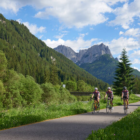
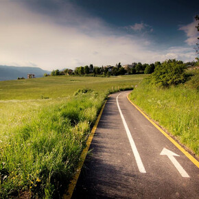
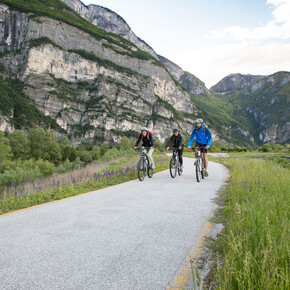
    Also called “La via del Brenta”, this is one of the most beautiful and top cycling paths in Europe.
    moderate
    Distance 52.4 km
    5:30 h
    166 m
    415 m
    492 m
    220 m
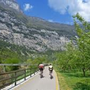
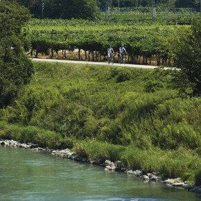
    It is a 52 km cycling/hiking path of Valsugana up to the border with the province of Vicenza. There are long sections where the track follows the Brenta river. There are no particular difficulties in terms of altitude, and it is suitable for cyclists of all skill levels. About half the route follows secondary roads that are open to traffic, but where you are unlikely to encounter motorised vehicles.
    Profile picture of VisitTrentino
    Author
    VisitTrentino
    Responsible for this content
    VisitTrentino  Verified partner 
    Difficulty
    moderate
    Overall difficulty
    moderate

    Derived from the technical difficulty and the stamina requirements.

    Experience
    Landscape
    Highest point
    492 m
    Lowest point
    220 m
    Best time of year
    Jan
    Feb
    Mar
    Apr
    May
    Jun
    Jul
    Aug
    Sep
    Oct
    Nov
    Dec

    Track types

    Show elevation profile

    Rest stops

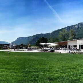
    Bicigrill Tezze - Valsugana Rent Bike

    Safety information

    Please note that the practicability of the itineraries in a mountain environment is strictly linked to the contingent conditions and is therefore influenced by natural phenomena, environmental changes and weather conditions. For this reason, the information contained in this page may have changed. Before leaving for a tour, make sure the path you will approach is still accessible by contacting the owner of the mountain hut, the alpine guides or the visitor centres of the nature parks, the info offices of the local tourist board.

    Public transport

    The railway stations along the Trento-Venice line are spread out throughout the route, just a few kilometres from one another, and they represent a tempting opportunity to comfortably return to the starting point or to start from whichever town you choose: on many trains, in fact, you will find a bicycle transport service. For information on this service: www.trasporti.provincia.tn.it/trasporto_bici/

    Directions

    Valsugana can be reached by car via Motorway A22 del Brennero - exit at Trento Nord. S.S. 47 della Valsugana, exit at Pergine Valsugana.

    Coordinates

    DD
    46.063345, 11.232662
    DMS
    46°03'48.0"N 11°13'57.6"E
    UTM
    32T 672681 5103509
    w3w 
    ///flat.booklet.cheer
    Get there by train, car, bike, or on foot!

    Similar routes nearby

    • The Valsugana Cycling Path
    • Bicycle touring along the Adige plain
    • Visit to the MUSE and stop at the Bici Grill!
    • Trento in bici
    • The Avisiane hills
     These suggestions were generated by our system
    Difficulty
    moderate
    Overall difficulty
    moderate

    Derived from the technical difficulty and the stamina requirements.

    Distance
    52.4 km
    Duration
    5:30 h
    Ascent
    166 m
    Descent
    415 m
    Highest point
    492 m
    Lowest point
    220 m
    Refreshment stops available Cultural/historical interest Flora Linear route Insider tip

    Weather at the starting point

    10-day forecast

    Statistics

    • Content
    • Show images Hide images
    Features
    2D 3D
    Maps and trails
    Nothing selected - click and drag in the elevation profile to zoom
    Distance
    Duration
    Ascent
    Descent
    Elevation profile


    You may also like ...

    29 results
    Bicycle touring along the Adige plain | © APT Trento

    Bicycle touring along the Adige plain

    Pista Ciclabile Val Rendena | © VisitTrentino

    Val Rendena Bike Path

    Pista Ciclabile del Basso Sarca | © VisitTrentino

    Mori-Torbole bike path

    Pista Ciclabile Valle dei Laghi | © VisitTrentino

    Valle del Sarca bike Path

    Valle dell'Adige Nord Cycling Path | © VisitTrentino

    Valle dell'Adige Nord Cycling Path

    The Avisiane hills. Cycling towards San Michele all’Adige | © Consorzio Turistico Piana Rotaliana Königsberg

    The Avisiane hills

    BiciGrill Trento sud | © APT Trento

    Visit to the MUSE and stop at the Bici Grill!

    Pedalando all'ombra del Castello di Avio | © APT Rovereto Vallagarina Monte Baldo

    Cycling among wineries and castles

    Bicycle touring along the Adige plain | © APT Trento

    Bicycle touring along the Adige plain

    An original 64-kilometer route that explores the banks of Trent and...

    Read more ...
    Pista Ciclabile Val Rendena | © VisitTrentino

    Val Rendena Bike Path

    Read more ...
    Pista Ciclabile del Basso Sarca | © VisitTrentino

    Mori-Torbole bike path

    This track joins the Vallagarina to the area of Lake Garda, and is...

    Read more ...
    Pista Ciclabile Valle dei Laghi | © VisitTrentino

    Valle del Sarca bike Path

    The Valle dei Laghi walking and cycling path starts from the shores...

    Read more ...
    Valle dell'Adige Nord Cycling Path | © VisitTrentino

    Valle dell'Adige Nord Cycling Path

    Read more ...
    The Avisiane hills. Cycling towards San Michele all’Adige | © Consorzio Turistico Piana Rotaliana Königsberg

    The Avisiane hills

    Beautiful circular route (No. 5 on the tourist map), which begins in...

    Read more ...
    BiciGrill Trento sud | © APT Trento

    Visit to the MUSE and stop at the Bici Grill!

    On the bike path to the Bicigrill in South Trent, where the...

    Read more ...
    Pedalando all'ombra del Castello di Avio | © APT Rovereto Vallagarina Monte Baldo

    Cycling among wineries and castles

    Between wineries and castles on your two wheels!

    Read more ...