Freeride at Passo del Tonale
Freeride skiing
Freeride at Passo del Tonale
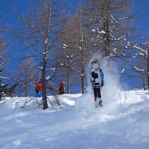
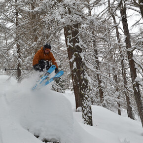
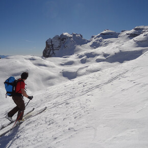
For off-piste skiing lovers, the Passo del Tonale-Presena Glacier Ski Area has rightfully become one of the most sought-after destinations across the entire Alpine range!
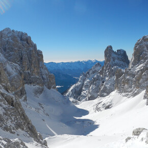
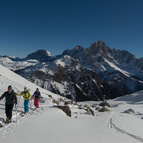
<p>The Passo del Tonale ski area is definitely the best destination for off-piste skiing in all of western Trentino, thanks to several factors such as altitude (skiing between 1900m and 3000m), exposure (mostly North), and the morphology of the terrain which features a series of valleys and channels of varying angle and difficulty.<br/>Descents like “Il Cantiere” or “il Canale del Diavolo”, just for example, attract freeride enthusiasts from across Europe.</p> <p>A typical day can still include a “warm-up” descent on the Vescasa off-piste, reachable from the Alpino chairlift (south-facing slope), a second descent precisely in the classic Cantiere valley, reachable from the Presena glacier lifts, and a last one on the steeper Diavolo channel, also reachable from the Presena lifts with 10 minutes of ascent carrying skis on your shoulder (80m elevation gain).</p>
Freeride at Passo del Tonale
VisitTrentino Verified partner
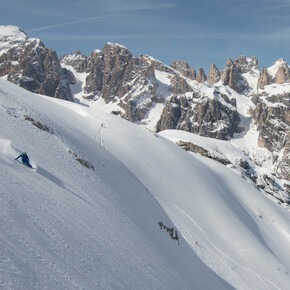
The Passo del Tonale ski area is definitely the best destination for off-piste skiing in all of western Trentino, thanks to several factors such as altitude (skiing between 1900m and 3000m), exposure (mostly North), and the morphology of the terrain which features a series of valleys and channels of varying angle and difficulty.
Descents like “Il Cantiere” or “il Canale del Diavolo”, just for example, attract freeride enthusiasts from across Europe.
A typical day can still include a “warm-up” descent on the Vescasa off-piste, reachable from the Alpino chairlift (south-facing slope), a second descent precisely in the classic Cantiere valley, reachable from the Presena glacier lifts, and a last one on the steeper Diavolo channel, also reachable from the Presena lifts with 10 minutes of ascent carrying skis on your shoulder (80m elevation gain).
Author’s recommendation
VisitTrentino Verified partner
Derived from the technical difficulty and the stamina requirements.
Track types
Show elevation profileSafety information
The stability of the snow cover is subject to sudden and unpredictable changes. Always consult the avalanche bulletin (www.meteotrentino.it) and get well informed about the current conditions at the offices of the Alpine Guides. https://www.guidealpinevaldisole.it
It is reminded that off-piste skiing activity within the ski resort area is regulated and subject to restrictions: make sure to be well informed about existing bans and the presence of any areas prohibited from the lift departures.
Also, gpx tracks are purely indicative of the generally most sensible route, but cannot be followed blindly without a preliminary slope evaluation at that precise moment.
As you can imagine, the passability of the routes in a mountain environment is strictly linked to the current conditions and therefore depends on natural phenomena, environmental changes, and weather conditions. For this reason, the information contained in this card may have changed. Before leaving, get informed about the status of the route by contacting the hut managers on your route, alpine guides, visitor centers of natural parks, and tourist offices.
Tips and suggestions
Ski Area
https://www.valdisole.net/it/Adamello-Ski-Pontedilegno-Tonale/
Local alpine guides:
Roadbook
There are many beautiful and recommended routes, but here we have included what is perhaps the classic descent par excellence: the legendary Cantiere.
The start of this descent is as convenient as you can imagine, being just a few dozen meters from the upper station of the new Presena cable car.
The first part is perhaps the steepest (30°) and should be tackled with care, while it is then important to follow the morphology of the terrain, following the gentler slopes and avoiding getting too close to the steep side slopes that close the valley.
Once you reach the final flat area, 300 flat meters where you have to push a little lead to the return road (former military road) that leads to the tunnel (to be tackled carrying skis on your shoulder - be careful of ice inside!) which allows you to return towards Passo del Tonale.
Directions
Go up the Val di Sole to Passo del Tonale, then just after crossing the pass reach the large parking lot (on the left) where the lifts to the Presena glacier start.Parking
Wide parking possibilities.Coordinates
Book recommendation by the author
Author’s map recommendations
Equipment
For all off-piste skiing excursions, appropriate clothing is recommended even in case of sudden temperature drops and waterproof to contact with snow (waterproof garments like Gore-Tex). In addition, gloves, hat, sunglasses, and sunscreen should be part of each group member’s normal equipment.
It is reminded that ski boots that are too tight or not sufficiently waterproof can cause the beginnings of frostbite on the feet.
It is MANDATORY to have avalanche self-rescue kit, composed of ARTVA, shovel, probe (which can also be rented).
Helmet or other active protection systems (such as backpacks with ABS-Airbag systems) are highly recommended.
Derived from the technical difficulty and the stamina requirements.


