Olympics 2026

Milano Cortina - Offical Partner for Olympics and Paralympics 2026

Cycle path Fassa and Fiemme Valleys

Long distance cycling • Val di Fassa

Long distance cycling recommended route

Cycle path Fassa and Fiemme Valleys

Long distance cycling · Val di Fassa
Responsible for this content
VisitTrentino Verified partner 
  • Photo: PhMatteoZanca_YourBigStories per APT Val di Fassa, VisitTrentino
Map / Cycle path Fassa and Fiemme Valleys

Selected alternatives for you
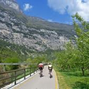
    The cycle path crosses the Fassa and Fiemme Valleys, following the route of the Marcialonga
    moderate
    Distance 42 km
    3:22 h
    39 m
    626 m
    1,388 m
    797 m
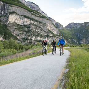
    These valleys are the kingdom of snow which, in summer, gives way to green meadows and the white Dolomia rocks. Indeed, the majestic Dolomites of Latemar and Catinaccio form the backdrop. The cycle path connecting the Fassa and Fiemme Valleys stretches for over 40 km through woods and dense forests of firs and larches. The route largely retraces the path of the Marcialonga and that of the ancient Ora – Predazzo railway.

    Author’s recommendation

    The route can be tackled in both directions: here the route is described starting from the Val di Fassa descending to Molina di Fiemme. This direction does not involve uphill climbs, but it is advisable to pay attention to some downhill sections. There is a return service with shuttle bus that requires mandatory reservation.

    Profile picture of VisitTrentino
    Author
    VisitTrentino
    Responsible for this content
    VisitTrentino  Verified partner 
    Difficulty
    moderate
    Overall difficulty
    moderate

    Derived from the technical difficulty and the stamina requirements.

    Experience
    Landscape
    Highest point
    1,388 m
    Lowest point
    797 m
    Best time of year
    Jan
    Feb
    Mar
    Apr
    May
    Jun
    Jul
    Aug
    Sep
    Oct
    Nov
    Dec

    Track types

    Show elevation profile

    Safety information

    As you can imagine, the accessibility of routes in a mountainous environment is closely linked to current conditions and therefore depends on natural phenomena, environmental changes, and weather conditions. For this reason, the information in this card may have changed. Before setting off, check the status of the route by contacting the refuge managers on your path, alpine guides, natural park visitor centers, and tourist offices.

    Directions

    Fontanazzo is easily reachable both from the south and north via State Road 12 of the Brenner or the A22 motorway (Egna/Ora exit 24 km away, Trento Nord or S.Michele) then continuing on the SS 48 Dolomites state road (from Egna/Ora).

    Coordinates

    DD
    46.467965, 11.729352
    DMS
    46°28'04.7"N 11°43'45.7"E
    UTM
    32T 709547 5149663
    w3w 
    ///dizzied.regrouped.shabby
    Get there by train, car, bike, or on foot!

    Localization

    Parts of this content were machine translated using Italian as the source language

    Difficulty
    moderate
    Overall difficulty
    moderate

    Derived from the technical difficulty and the stamina requirements.

    Distance
    42 km
    Duration
    3:22 h
    Ascent
    39 m
    Descent
    626 m
    Highest point
    1,388 m
    Lowest point
    797 m
    Scenic Refreshment stops available Geological highlights Insider tip

    Weather at the starting point

    10-day forecast

    Statistics

    • Content
    • Show images Hide images
    Features
    2D 3D
    Maps and trails
    Nothing selected - click and drag in the elevation profile to zoom
    Distance
    Duration
    Ascent
    Descent
    Elevation profile


    You may also like ...

    30 results
    Cyclotourism along the Adige plain | © APT Trento

    Cyclotourism along the Adige plain

    Pista Ciclabile Val Rendena | © VisitTrentino

    Val Rendena Bike Path

    Pista Ciclabile del Basso Sarca | © VisitTrentino

    Mori-Torbole bike path

    Pista Ciclabile Valle dei Laghi | © VisitTrentino

    Valle del Sarca bike Path

    Valle dell'Adige Nord Cycling Path | © VisitTrentino

    Valle dell'Adige Nord Cycling Path

    Colline Avisiane. Cycling towards San Michele all'Adige | © Consorzio Turistico Piana Rotaliana Königsberg

    The Avisiane hills

    BiciGrill Trento south | © APT Trento

    Visit the MUSE and stop at the Bici Grill!

    Valsugana Bike paths | © VisitTrentino

    Valsugana Bike paths

    Cyclotourism along the Adige plain | © APT Trento

    Cyclotourism along the Adige plain

    An original 64 km route exploring the banks of Trento and the Adige...

    Read more ...
    Pista Ciclabile Val Rendena | © VisitTrentino

    Val Rendena Bike Path

    Read more ...
    Pista Ciclabile del Basso Sarca | © VisitTrentino

    Mori-Torbole bike path

    This track joins the Vallagarina to the area of Lake Garda, and is...

    Read more ...
    Pista Ciclabile Valle dei Laghi | © VisitTrentino

    Valle del Sarca bike Path

    The Valle dei Laghi walking and cycling path starts from the shores...

    Read more ...
    Valle dell'Adige Nord Cycling Path | © VisitTrentino

    Valle dell'Adige Nord Cycling Path

    Read more ...
    Colline Avisiane. Cycling towards San Michele all'Adige | © Consorzio Turistico Piana Rotaliana Königsberg

    The Avisiane hills

    Beautiful circular route (No. 5 on the tourist map), which begins in...

    Read more ...
    BiciGrill Trento south | © APT Trento

    Visit the MUSE and stop at the Bici Grill!

    On the cycle path up to the Bicigrill at Trento South, where the...

    Read more ...
    Valsugana Bike paths | © VisitTrentino

    Valsugana Bike paths

    Also called “La via del Brenta”, this is one of the most...

    Read more ...