Olympics 2026

Milano Cortina - Offical Partner for Olympics and Paralympics 2026

Mori-Torbole bike path

Long distance cycling • Rovereto, Vallagarina, Altopiano di Brentonico

Long distance cycling recommended route

Mori-Torbole bike path

Long distance cycling · Rovereto, Vallagarina, Altopiano di Brentonico
Responsible for this content
VisitTrentino Verified partner 
  • Pista Ciclabile del Basso Sarca
    Pista Ciclabile del Basso Sarca
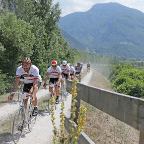
    Photo: VisitTrentino, VisitTrentino
Map / Mori-Torbole bike path

Selected alternatives for you
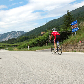
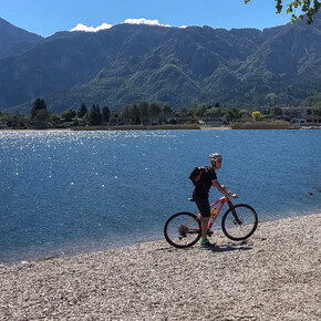
    This track joins the Vallagarina to the area of Lake Garda, and is connected to the Valle dell’Adige cycling path that goes from Trento to Rovereto.
    easy
    Distance 19.6 km
    2:30 h
    291 m
    331 m
    276 m
    62 m
    Profile picture of VisitTrentino
    Author
    VisitTrentino
    Responsible for this content
    VisitTrentino  Verified partner 
    Difficulty
    easy
    Overall difficulty
    easy

    Derived from the technical difficulty and the stamina requirements.

    Experience
    Landscape
    Highest point
    276 m
    Lowest point
    62 m
    Best time of year
    Jan
    Feb
    Mar
    Apr
    May
    Jun
    Jul
    Aug
    Sep
    Oct
    Nov
    Dec

    Track types

    Show elevation profile

    Safety information

    Please note that the practicability of the itineraries in a mountain environment is strictly linked to the contingent conditions and is therefore influenced by natural phenomena, environmental changes and weather conditions. For this reason, the information contained in this page may have changed. Before leaving for a tour, make sure the path you will approach is still accessible by contacting the owner of the mountain hut, the alpine guides or the visitor centres of the nature parks, the info offices of the local tourist board.

    Directions

    Mori is comfortable to reach from both the south and the north along National road 12 del Brennero, or motorway A22 (exit at Rovereto Sud, 1 km from the toll gate), or on National road SS 240 coming from Riva del Garda, SP 23 for those coming from Marco, SP 90 destra Adige, SP 3 which comes down from Brentonico, and SP 88 which follows the Val di Gresta.


    Coordinates

    DD
    45.851790, 10.994604
    DMS
    45°51'06.4"N 10°59'40.6"E
    UTM
    32T 654857 5079515
    w3w 
    ///pulp.moped.business
    Get there by train, car, bike, or on foot!

    Similar routes nearby

    • Cycling among wineries and castles
    • Vallagarina Experience Bike Tour
    • Along the Marzemino wine route
    • From Rovereto to Nomi with your bicycle
    • Along the Casetta wine route
     These suggestions were generated by our system
    Difficulty
    easy
    Overall difficulty
    easy

    Derived from the technical difficulty and the stamina requirements.

    Distance
    19.6 km
    Duration
    2:30 h
    Ascent
    291 m
    Descent
    331 m
    Highest point
    276 m
    Lowest point
    62 m
    Scenic Refreshment stops available Insider tip Linear route

    Weather at the starting point

    10-day forecast

    Statistics

    • Content
    • Show images Hide images
    Features
    2D 3D
    Maps and trails
    Nothing selected - click and drag in the elevation profile to zoom
    Distance
    Duration
    Ascent
    Descent
    Elevation profile


    You may also like ...

    29 results
    Bicycle touring along the Adige plain | © APT Trento

    Bicycle touring along the Adige plain

    Pista Ciclabile Val Rendena | © VisitTrentino

    Val Rendena Bike Path

    Pista Ciclabile Valle dei Laghi | © VisitTrentino

    Valle del Sarca bike Path

    Valle dell'Adige Nord Cycling Path | © VisitTrentino

    Valle dell'Adige Nord Cycling Path

    The Avisiane hills. Cycling towards San Michele all’Adige | © Consorzio Turistico Piana Rotaliana Königsberg

    The Avisiane hills

    BiciGrill Trento sud | © APT Trento

    Visit to the MUSE and stop at the Bici Grill!

    Valsugana Bike paths | © VisitTrentino

    Valsugana Bike paths

    Pedalando all'ombra del Castello di Avio | © APT Rovereto Vallagarina Monte Baldo

    Cycling among wineries and castles

    Bicycle touring along the Adige plain | © APT Trento

    Bicycle touring along the Adige plain

    An original 64-kilometer route that explores the banks of Trent and...

    Read more ...
    Pista Ciclabile Val Rendena | © VisitTrentino

    Val Rendena Bike Path

    Read more ...
    Pista Ciclabile Valle dei Laghi | © VisitTrentino

    Valle del Sarca bike Path

    The Valle dei Laghi walking and cycling path starts from the shores...

    Read more ...
    Valle dell'Adige Nord Cycling Path | © VisitTrentino

    Valle dell'Adige Nord Cycling Path

    Read more ...
    The Avisiane hills. Cycling towards San Michele all’Adige | © Consorzio Turistico Piana Rotaliana Königsberg

    The Avisiane hills

    Beautiful circular route (No. 5 on the tourist map), which begins in...

    Read more ...
    BiciGrill Trento sud | © APT Trento

    Visit to the MUSE and stop at the Bici Grill!

    On the bike path to the Bicigrill in South Trent, where the...

    Read more ...
    Valsugana Bike paths | © VisitTrentino

    Valsugana Bike paths

    Also called “La via del Brenta”, this is one of the most...

    Read more ...
    Pedalando all'ombra del Castello di Avio | © APT Rovereto Vallagarina Monte Baldo

    Cycling among wineries and castles

    Between wineries and castles on your two wheels!

    Read more ...