Open Air Gallery: art in the open air in Drena
Hiking trail
Open Air Gallery: art in the open air in Drena
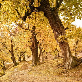
<p>Lots of different unexpected installations, objects and splashes of colour which transform the woods into an open air art gallery</p>
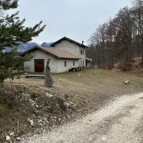
<p>There are two trails you can take, the Sun Path or the Moon Path, which cross in the woods and are dotted with works of art which blend into the landscape. Animals, fantastic objects, and colour bring to life a world where imagination rules.</p> <p>The idea behind this trail is this: archaeologists are always looking for traces of peoples from the past in an attempt to reconstruct their identity, culture and history through their crafts and objects. The Open Air Gallery aims to be a sort of <strong>“archaeological site of the future”</strong>, a work of art and crafts which can be interpreted by our descendents</p>
Open Air Gallery: art in the open air in Drena

Garda Trentino Verified partner
Lots of different unexpected installations, objects and splashes of colour which transform the woods into an open air art gallery
There are two trails you can take, the Sun Path or the Moon Path, which cross in the woods and are dotted with works of art which blend into the landscape. Animals, fantastic objects, and colour bring to life a world where imagination rules.
The idea behind this trail is this: archaeologists are always looking for traces of peoples from the past in an attempt to reconstruct their identity, culture and history through their crafts and objects. The Open Air Gallery aims to be a sort of “archaeological site of the future”, a work of art and crafts which can be interpreted by our descendents
Author’s recommendation
Children will have fun discovering the funny creatures and the strange objects that populate the path and the wood!
Garda Trentino Verified partner
Derived from the technical difficulty and the stamina requirements.
Track types
Safety information
The information on this chart is subject to inevitable variations, so this means that none of the indications are absolute. It is not entirely possible to avoid giving inexact or imprecise information, given how quickly environmental and weather conditions can change. For this reason we decline any responsibility for changes which the user may encounter. In any case, the hiker is advised to check the conditions of the places, environment and weather before setting out.
Tips and suggestions
You’ve picked the perfect trail – now make sure you’re ready to enjoy it to the fullest. Local hiking specialists are here to help: guides, shops and experts with the tips and support you need for every step of the way.Public transport
Drena is connected with the other towns in Garda Trentino by the number 304 intercity bus line. Details and timetables: www.gardatrentino.it
Get Timetable to destination
Directions
To get to Drena take the road strada statale 45 bis in the direction of Arco/Dro/Trento, and at Dro turn off onto strada provinciale 84 in the direction of Drena. From here on follow directions for Braila.
Getting to northern lake Garda / Garda Trentino: www.gardatrentino.it
Parking
Free car parking at the start of the trail
Coordinates
Author’s map recommendations
-
Garda Trentino trekking map – On sale in information offices in Riva del Garda, Arco and Torbole
Equipment
You need to be wearing the right clothing and take the proper gear when you go hiking in the mountains. Even on relatively short easy outings make sure to take all you need so you don't run into trouble if things take an unexpected turn, for example a storm blows up or you have a sudden drop in energy levels.
What should you take when you go on a hike?
What you should have in your rucksack (for a day trip a 25/30L capacity should do):
- water canteen (1L)
- snacks (e.g. mixed dried fruit or chocolate)
- First aid kit
- windproof jacket
- fleece
- change of t-shirt and socks (in a plastic bag)
- make sure to wear or at least bring a pair of long trousers
- hat
- sun screen
- sunglasses
- gloves
- whistle to attract attention in an emergency
- emergency telephone number Mountain Rescue 112
Make sure you're wearing the right footwear for the trail and season. The going can get rough and rocky underfoot and a pair of hiking boots will protect you from sprains.
When wet, a grassy slope, rocky slab or steep trail can be dangerous unless you are wearing the proper footwear.
And finally...
... don't forget to bring your camera! You'll need it to capture the stunning views you come across all over Garda Trentino. And if you like, you can share your memories with us at #GardaTrentino.
Derived from the technical difficulty and the stamina requirements.


