Sentiero del Latte
Hiking trail • Terme di Comano - Dolomiti di Brenta
Sentiero del Latte
<p>Embark on a journey to explore the rural mountain economy of Fiavé and Favrio, centred around the production of milk and its various derivatives.</p>
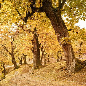
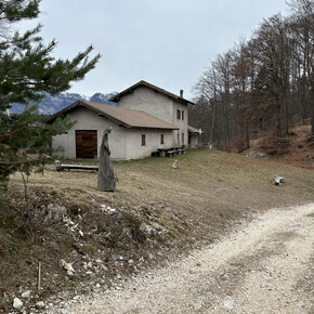
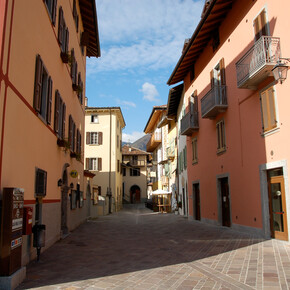
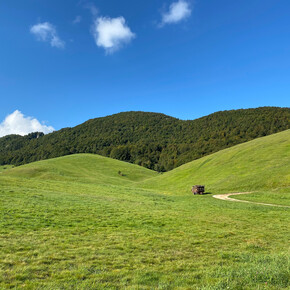
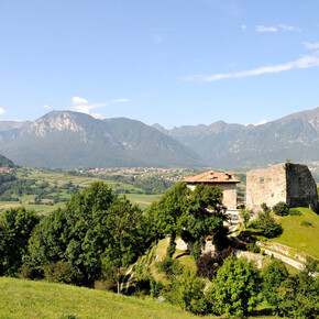
<p>The Sentiero del Latte starts in Fiavé and heads towards the small hamlet of Favrio, passing through a stretch of woodland. On the way back the trail skirts the peat bog nature reserve. Along the route you'll find small and large stables, green meadows, cornfields and woods, some of which are grazing grounds for animals in fine weather.</p> <p>Not to be missed: the villages of Fiavé and Favrio with their typical rural architecture, in particular the fascinating ère, large spaces located on the first floor of farmhouses, which were once used to store hay and fodder and were accessed via stone bridges.</p>
Sentiero del Latte

Garda Trentino Verified partner
Embark on a journey to explore the rural mountain economy of Fiavé and Favrio, centred around the production of milk and its various derivatives.
The Sentiero del Latte starts in Fiavé and heads towards the small hamlet of Favrio, passing through a stretch of woodland. On the way back the trail skirts the peat bog nature reserve. Along the route you'll find small and large stables, green meadows, cornfields and woods, some of which are grazing grounds for animals in fine weather.
Not to be missed: the villages of Fiavé and Favrio with their typical rural architecture, in particular the fascinating ère, large spaces located on the first floor of farmhouses, which were once used to store hay and fodder and were accessed via stone bridges.
Author’s recommendation
A short detour through the peat bog leads to Parco Archeo Natura, an archaeological area which has been a UNESCO World Heritage Site since 2011.
Garda Trentino Verified partner
Derived from the technical difficulty and the stamina requirements.
Track types
Safety information
The telephone number for the emergency services is 112.
The information on this chart is subject to inevitable variations, so this means that none of the indications are absolute. It is not entirely possible to avoid giving inexact or imprecise information, given how quickly environmental and weather conditions can change. For this reason we decline any responsibility for changes which the user may encounter. In any case, the hiker is advised to check the conditions of the places, environment and weather before setting out.
Tips and suggestions
You’ve picked the perfect trail – now make sure you’re ready to enjoy it to the fullest. Local hiking specialists are here to help: guides, shops and experts with the tips and support you need for every step of the way.Roadbook
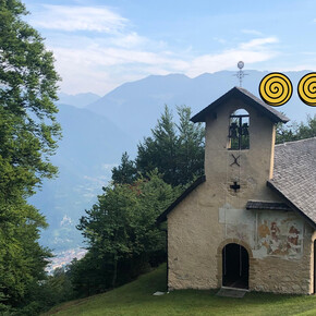
From Fiavé, we follow Via San Zeno as far as the church, where we turn right into Via Stumiaga. After a few metres, we turn left into the small road that leads down to the hamlet of Stumiaga. We cross the village and reach the main road. On the other side of the road, we take the path towards the cemetery and then turn right to follow the small road that runs parallel to the main road. After about 1 km, near a large stable, the path takes a sharp bend and continues uphill towards Favrio. When we reach the small church of San Biagio, we take the small road on the right and enter the forest. The route coincides with the SAT433 path for about 500 metres, but we soon leave it to take the path to the right. After up and down stretch of about 1 km, we meet the main road again, which we cross to take the country lane between the peat bog and the stable. Before reaching the Carera lake, we turn right to return to Fiavé.
Public transport
Fiavé is connected by the intercity bus line 211 (Riva del Garda - Tenno - Fiavè - Ponte Arche) to the other places in Garda Trentino.
Up-to-date information on timetables and routes.
Get Timetable to destination
Directions
Starting from Ponte Arche (Comano Terme) drive till Fiavé. On the main road nr. 421 at the cross, turn to the right at the center of the village, neat the church of San Sebastiano.
Find out how to reach Garda Trentino.
Parking
Free parking at the Fiavé tennis court.
Coordinates
Author’s map recommendations
Garda Trentino TREKKING Map – Available in the info points of Garda Trentino (Riva del Garda, Arco, Torbole sul Garda, Ledro, Comano Terme)
Equipment
This excursion is quite simple and presents no particular difficulty. However, we still recommend you to wear suitable footwear, a hat, sun screen and sunglasses. And be sure to bring water!
Localization
Derived from the technical difficulty and the stamina requirements.


